TAS 5431 – Lemont Online Sale
- Estimated Delivery : Up to 4 business days
- Free Shipping & Returns : On all orders over $200
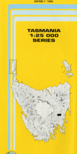
This Topographic Map is produced by the Department of Primary Industries, part of the Tasmanian Government.
These maps are an important resource for Government, industry, and the public. They are used for environmental and emergency management, farm planning and mineral exploration. They are also popular for recreational users such as bushwalkers, mountain bike and horse riders.
The PDF version of this can be printed at home or sent to a professional printer for a 100% scale reproduction.
At this scale, 4cm on this map represents 1km on the ground. A standard map (which is square) covers an area of approximately about 12.5km by 12.5km, with a contour interval of 10m. This map contains natural and constructed features including road and rail infrastructure, vegetation, hydrography, contours, localities and some administrative boundaries.
Woodburn Green Hills Attewatta Lyndhurst Birralee Casaveen Cremorne Miena Montlea Ashgrove Longacres Inglewood Fonthill Duckholes Creek Eastern Marshes Rivulet Ashgrove Lagoon Barwicks Flat Boomer Rivulet Casaveen Bluff Charles Brown Creek Charlies Mount Coffin Lagoon Crown Lagoon Cullins Creek Fitchs Hill Goat Gully Govetts Creek Harveys Lagoon Inglewood Hill Johnnys Lagoon Lemont Little China Tier Marshalls Sugarloaf Mary Dickson Creek Mount Cartwright Mount Wyndham Murderers Tier Oak Hill O Connors Sheepwash Old Hut Hill Pawtella Pencil Point Porcupine Hill Rises Sugarloaf Rushy Lagoon Scrubby Hill Sligo Creek Stony Lagoon Stony Sugarloaf Swanston Woods Lagoon Boomer Hill Pound Gully She Oak Hill
| Title | Pdf Download |
|---|