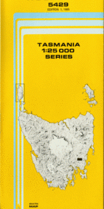
TAS 5429 – Woodsdale Online now
- Estimated Delivery : Up to 4 business days
- Free Shipping & Returns : On all orders over $200
This Topographic Map is produced by the Department of Primary Industries, part of the Tasmanian Government.
These maps are an important resource for Government, industry, and the public. They are used for environmental and emergency management, farm planning and mineral exploration. They are also popular for recreational users such as bushwalkers, mountain bike and horse riders.
The PDF version of this can be printed at home or sent to a professional printer for a 100% scale reproduction.
At this scale, 4cm on this map represents 1km on the ground. A standard map (which is square) covers an area of approximately about 12.5km by 12.5km, with a contour interval of 10m. This map contains natural and constructed features including road and rail infrastructure, vegetation, hydrography, contours, localities and some administrative boundaries.
Blue Gum Gully Bluff River Bluff River Gorge Cat Gut Gully Cat Hill Coarse Marsh Cornishs Hill Coxs Hill Crawfords Hill Cutting Grass Marsh Gathering Hill Home Hill Ironstone Creek Joes Hill Levendale Mount Douglas Mount Hobbs New Country Marsh Nutting Garden Rivulet Palmers Sugarloaf Pats Marsh Poison Hill Poulters Hill Rayners Hill Rayners Marsh Rockys Hill Sand Marsh Scotts Hill Sheepdip Creek Taffs Hill Tiger Hill Tin Pot Creek Tin Pot Creek Picnic Ground Tin Pot Marsh Weedings Hill Wiggins Hill Woodsdale Bluff Marsh Camp Creek Mount Ponsonby Forest Reserve Native Plains Sand River Forest Reserve Red Hill
| Title | Pdf Download |
|---|