TAS 5031 – Dennistoun Hot on Sale
- Estimated Delivery : Up to 4 business days
- Free Shipping & Returns : On all orders over $200
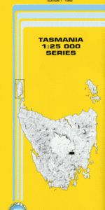
This Topographic Map is produced by the Department of Primary Industries, part of the Tasmanian Government.
These maps are an important resource for Government, industry, and the public. They are used for environmental and emergency management, farm planning and mineral exploration. They are also popular for recreational users such as bushwalkers, mountain bike and horse riders.
The PDF version of this can be printed at home or sent to a professional printer for a 100% scale reproduction.
At this scale, 4cm on this map represents 1km on the ground. A standard map (which is square) covers an area of approximately about 12.5km by 12.5km, with a contour interval of 10m. This map contains natural and constructed features including road and rail infrastructure, vegetation, hydrography, contours, localities and some administrative boundaries.
The Quoin Bowhill Glenview Rotherwood Merrivale Tryhard Dennistoun Pleasant Place Nant Woodspring Lynwood Merris Tregothan Badgers Marsh Basin Sugarloaf Beaver Hill Billygoat Hill Bisdee Creek Black Bridge Bow Hill Bryans Creek Burying Ground Hill Dead Mans Hill Dennistoun Plain Exe Rivulet Exe Sugarloaf Fordell Creek Fordell Marsh Freestone Hill Glenmore Sugarloaf Halfmoon Marsh Halfmoon Tier Handsome Hill Horse Hill Howells Hill Ironpot Gully Ironpot Gully Nature Reserve Ironpot Hill Jones Point Lagoon Hill Little Horse Hill Lower Marshes Monks Sugarloaf Moodys Hill Quoin Pinnacles Red Sugarloaf Rotherwood Lagoon Sandy Toms Rocks Sawpit Gully Shiners Hill Stags Head Stockyards Rise Stone Wall Hill Third Hill Tin Hut Hill Toms Hill Twelve O Clock Hill Woods Quoin Woodspring Lagoon Bretts Hill Burnt House Hill Cleared Hill Eaglehawk Gully Landslide Hill Muddy Creek Sheepwash Flat Stringy Bark Gully The Bitters Tin Mine Gully
| Title | Pdf Download |
|---|