TAS 5437 – Hanleth Sale
- Estimated Delivery : Up to 4 business days
- Free Shipping & Returns : On all orders over $200
This Topographic Map is produced by the Department of Primary Industries, part of the Tasmanian Government.
These maps are an important resource for Government, industry, and the public. They are used for environmental and emergency management, farm planning and mineral exploration. They are also popular for recreational users such as bushwalkers, mountain bike and horse riders.
The PDF version of this can be printed at home or sent to a professional printer for a 100% scale reproduction.
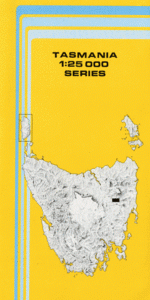
At this scale, 4cm on this map represents 1km on the ground. A standard map (which is square) covers an area of approximately about 12.5km by 12.5km, with a contour interval of 10m. This map contains natural and constructed features including road and rail infrastructure, vegetation, hydrography, contours, localities and some administrative boundaries.
Kelvin Grove York Plain Ellerslie Glen Esk Bona-Vista Estate Milford Brambletye Selma Benham Eastbourne Avoca Ben Stewart Bonneys Plains Brambletye Sugarloaf Castle Cary Connellys Hill Dead Cows Hill Hanleth Horse Paddock Gully Horseshoe Bend Hungry Hill Jubilee Lagoon Llewellyn Log Hut Gully Morgans Sugarloaf Mount Christie Packston Reserve Peaky Gully Pegs Hollow Creek Scotts Island Tommy Creek Turners Hill Bayntons Forest Bradys Hill Fork Gullies Little Back Hills Porters Gully Red Hill Sister St Pauls Bridge St Pauls River Bridge Stynes Creek Bridge The Gorge Ben Lomond Rivulet Buffalo Brook Salisbury Rivulet Llewellyn Siding Hanleth Siding Eastbourne Siding
| Title | Pdf Download |
|---|